|
|
|

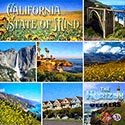
California: The Golden State & End of the Road
- Introduction
- Driving Route 66 Across California
- Major Route 66 Towns and Stops in California
- Classic Roadside Stops, Oddities, and Photo Ops
- Historic, Cultural, and Scenic Attractions
- Diners, Dives, Cafes, and Road Food
- Where to Stay Along the Route
- Worthwhile Side Trips and Short Detours from California Route 66
- Major Side Trips Worth the Detour
- Off the Beaten Path in California
- Traveler Notes
Introduction
California is the final state of Route 66, and it does not let travelers reach the Pacific easily. Before the beach, the pier, the palm trees, and the victory photo, the road crosses the Mojave Desert, one of the hottest and most demanding landscapes on the entire route. The old highway moves from the Colorado River at Needles through desert towns, railroad outposts, volcanic landscapes, abandoned service stations, Amboy, Ludlow, Newberry Springs, Barstow, Victorville, San Bernardino, Pasadena, Los Angeles, and finally Santa Monica. It is a dramatic finish: lonely desert, mountain pass, suburban sprawl, old commercial corridors, urban fragments, and the Pacific Ocean at the end.
California Route 66 is not one simple road anymore. In the Mojave, the old alignment can still feel remote, exposed, and powerful. In the Los Angeles Basin, Route 66 survives as fragments, boulevards, historic districts, signs, bridges, motels, diners, and symbolic endpoints woven into one of the largest metropolitan regions in the world. The romance is still there, but it is tangled in traffic, freeways, redevelopment, and the slightly absurd reality that after more than two thousand miles of historic highway, the final challenge may be finding parking near the beach.
Back to top
Driving Route 66 Across California
Historic Route 66 enters California from Arizona at the Colorado River near Needles, then crosses the Mojave Desert through or near Goffs, Essex, Amboy, Ludlow, Newberry Springs, Daggett, and Barstow. From there, the route continues through Victorville, the Cajon Pass area, San Bernardino, Rancho Cucamonga, Pasadena, Los Angeles, West Hollywood, Beverly Hills, and Santa Monica. The National Park Service describes California Route 66 as roughly 345 miles, beginning with one of the hottest desert legs and ending in the fragmented urban routes of the Los Angeles region.
The California section divides naturally into two very different experiences. The desert portion is open, remote, photogenic, and unforgiving. It has ghost-town energy, old gas stations, volcanic landscapes, abandoned alignments, railroad traces, and some of the most atmospheric ruins on Route 66. The urban portion is busy, complicated, culturally rich, and sometimes frustrating. Route 66 in Los Angeles is less a single road than a historical thread woven through boulevards, neighborhoods, bridges, old theaters, signs, restaurants, and commercial strips.
Travelers should be especially careful in the Mojave. Carry water, monitor fuel, check temperatures, and do not assume every old stop has services. Some places are iconic photo stops, not functioning towns. Once in the Los Angeles area, the challenge changes from desert survival to traffic survival, which is less romantic but no less real. California is the end of the road, but it makes you work for the ending.
Back to top
Major Route 66 Towns and Stops in California
Needles
Needles is the first major California Route 66 town for westbound travelers and one of the hottest places on the route. Sitting near the Colorado River, it served generations of desert travelers, railroad traffic, motorists, and migrants moving west. Today it offers old motels, murals, railroad history, river access, and the unmistakable feeling that California has begun with a heat warning and a sense of humor.
- What to See: Route 66 murals, historic motels, railroad district, El Garces area, Colorado River access, and old highway alignments.
- Why It Matters: Needles introduces California's desert Route 66 story and marks the transition from Arizona's mountain and river country into the Mojave.
- Traveler Tip: Take heat seriously. Needles is not "warm." Needles is where your dashboard may begin questioning your choices.
Goffs
Goffs is a small but important Mojave Desert stop with schoolhouse history, railroad context, and old-road atmosphere. It sits along one of the older desert alignments and gives travelers a quieter view of Route 66 history away from the interstate. This is not a big neon stop. It is a desert-history stop, and that difference matters.
- What to See: Goffs Schoolhouse area, desert road alignments, railroad and mining context, and Mojave landscape.
- Why It Matters: Goffs helps connect Route 66 with desert settlement, education, mining, railroads, and early automobile travel.
- Traveler Tip: Check access and hours before making this a planned stop. Desert historical sites are not always open on your personal schedule, inconsiderate though that may seem.
Essex and the Mojave Desert Stretch
Between Needles and Amboy, the old road crosses one of the most isolated and atmospheric stretches of California Route 66. Essex and nearby desert outposts speak to the practical demands of early automobile travel: fuel, water, shade, repairs, and the hope that the next service station had not closed permanently sometime during the Eisenhower administration. This part of the route is powerful precisely because it feels so exposed.
- What to See: Desert roadbeds, old service sites, railroad traces, mountain views, open Mojave scenery, and long empty stretches of historic highway.
- Why It Matters: This stretch shows why the California desert was one of the most challenging sections of Route 66 for early motorists and Dust Bowl migrants.
- Traveler Tip: Do not drive this section casually in extreme heat or with low fuel. Route 66 nostalgia will not change a flat tire for you.
Amboy
Amboy is one of the great desert icons of California Route 66. Roy's Motel and Cafe, the old sign, the gas station, the school, and the nearby Amboy Crater make the town feel like a half-dreamed movie set on the edge of the Mojave. Amboy declined after interstate traffic bypassed it, but its preservation and revival efforts have kept it alive as a classic desert stop. It is one of the most photogenic places on the California route, especially in desert light.
- What to See: Roy's Motel and Cafe sign, Amboy School, old service buildings, Amboy Crater nearby, Route 66 shields, and Mojave Desert scenery.
- Why It Matters: Amboy is one of the defining desert Route 66 stops, representing both roadside commerce and the impact of bypassed traffic.
- Traveler Tip: Photograph respectfully, check current services before relying on fuel or food, and remember that desert icons are not always fully functioning towns.
Ludlow and Newberry Springs
Ludlow and Newberry Springs are classic desert corridor stops between Amboy and Barstow. Ludlow has old motel and service-station remnants, while Newberry Springs is known for the Bagdad Cafe, made famous by the film of the same name. This stretch shows the California desert route at its most road-worn and cinematic: rails, dust, sun, abandoned buildings, and the occasional surviving business that seems to exist partly because the desert forgot to take it back.
- What to See: Old Ludlow buildings, Bagdad Cafe in Newberry Springs, desert alignments, railroad scenery, and roadside remnants.
- Why It Matters: These stops preserve the desert service-town and film-location side of California Route 66.
- Traveler Tip: Treat this as a limited-services stretch. Check what is open before assuming you can casually find lunch, fuel, or air conditioning.
Daggett
Daggett is one of the oldest desert communities on the California route, tied to mining, railroads, and the pre-Route 66 transportation corridors of the Mojave. It sits near Barstow but feels more like an older desert town than a major traveler-service hub. Daggett is a good reminder that Route 66 often followed older paths already shaped by mining camps, rail lines, wagon roads, and desert survival.
- What to See: Historic buildings, old road alignments, railroad and mining context, and desert-town streetscapes.
- Why It Matters: Daggett connects Route 66 to the deeper Mojave history that predates the highway.
- Traveler Tip: This is best for travelers who enjoy older desert-town remnants and local history rather than polished roadside tourism.
Barstow
Barstow is the major desert hub of California Route 66. It has railroad history, museums, motels, murals, Harvey House architecture, and access to several major desert side trips. After the long Mojave crossing, Barstow feels like a place where travelers can reset, refuel, and rejoin civilization, or at least the version of civilization that includes freight trains, desert wind, fast food, and a surprising amount of Route 66 history.
- What to See: Route 66 Mother Road Museum, Casa del Desierto Harvey House, Western America Railroad Museum, murals, old motels, and nearby Calico Ghost Town.
- Why It Matters: Barstow is the primary Mojave Desert Route 66 service and interpretation center in California.
- Traveler Tip: Barstow is practical and historically useful. It may not be glamorous, but after the desert stretch, practical starts looking pretty good.
Oro Grande and Victorville
Oro Grande and Victorville mark the route's movement toward the western Mojave and the approach to Cajon Pass. Oro Grande has some quirky roadside character, while Victorville is home to the California Route 66 Museum. This section is more populated than the Amboy stretch but still carries desert-road atmosphere, especially where older alignments and roadside buildings survive.
- What to See: Elmer's Bottle Tree Ranch area if accessible, California Route 66 Museum in Victorville, old road alignments, desert roadside buildings, and Mojave River context.
- Why It Matters: This area connects the remote Mojave section with the more developed route toward the Los Angeles Basin.
- Traveler Tip: Check current status before visiting smaller quirky stops. Some beloved roadside attractions may have limited access or changing conditions.
Cajon Pass
Cajon Pass is the dramatic mountain gateway between the Mojave Desert and the Los Angeles Basin. Route 66, railroads, freeways, and older trails all squeeze through this corridor between mountain ranges. For westbound travelers, Cajon Pass is the moment California begins changing again: the desert gives way to the crowded, sprawling, complicated world of Southern California.
- What to See: Mountain pass scenery, railroad corridors, old road alignments, and views where safely accessible.
- Why It Matters: Cajon Pass was one of the great physical thresholds of Route 66, linking desert travel with the Los Angeles region.
- Traveler Tip: Traffic can be heavy and conditions can change quickly. This is not the place to romanticize poor lane discipline.
San Bernardino
San Bernardino was one of the major inland Southern California Route 66 cities, with motel strips, diners, citrus-era history, migration stories, and access to mountain and desert routes. It also has ties to early fast-food history through the original McDonald's site, now a museum. San Bernardino carries both the promise and the hard reality of Route 66's California arrival: opportunity, sprawl, industry, redevelopment, and plenty of rough edges.
- What to See: Original McDonald's Museum, historic Route 66 corridors, old motels, local murals, and nearby mountain access.
- Why It Matters: San Bernardino connects Route 66 with California migration, car culture, fast food, postwar growth, and Inland Empire history.
- Traveler Tip: Plan stops carefully and be aware of neighborhood context. This is a real city, not a preserved roadside village.
Rancho Cucamonga and the Foothill Boulevard Corridor
Foothill Boulevard carries much of the Route 66 story through the Inland Empire and San Gabriel Valley. Rancho Cucamonga and surrounding communities preserve old roadside architecture, signs, restaurants, commercial strips, and the suburban transformation of the highway. This is where Route 66 becomes less about isolated desert stops and more about the way the road was absorbed into everyday Southern California life.
- What to See: Foothill Boulevard alignments, historic signs, roadside buildings, local restaurants, and old motor-court remnants where they survive.
- Why It Matters: This corridor shows how Route 66 became part of suburban Southern California rather than disappearing completely.
- Traveler Tip: The history here is fragmented. Look for individual buildings, signs, and districts rather than expecting a continuous nostalgic streetscape.
Pasadena
Pasadena is one of the most culturally rich urban stops near the western end of Route 66. The Colorado Street Bridge, historic districts, old theaters, architecture, museums, and Colorado Boulevard corridor all give Pasadena a strong sense of place. It also marks the route's deep movement into the Los Angeles metropolitan area, where the old road becomes layered under city traffic, urban history, and a lot of people who have no idea you are trying to have a meaningful Route 66 moment in the next lane.
- What to See: Colorado Street Bridge, Old Pasadena, Colorado Boulevard, Pasadena Playhouse District, Gamble House, Norton Simon Museum, and historic architecture.
- Why It Matters: Pasadena connects Route 66 with Southern California architecture, early automobile suburbs, civic culture, and the approach to Los Angeles.
- Traveler Tip: Pasadena is worth real time. Park once and walk if possible, because driving block to block in Southern California can make a person question civilization.
Los Angeles
Los Angeles is the most complicated city on Route 66. The highway entered a region already transforming through cars, movies, migration, freeways, suburbs, and reinvention. Route 66 survives here in fragments: Broadway theaters, old commercial strips, signs, diners, bridges, motels, neighborhoods, and boulevards that once carried travelers toward the dream of California. It is not easy to follow, but it is deeply important.
- What to See: Downtown Los Angeles historic theaters, Broadway corridor, Highland Park and Eagle Rock Route 66 areas, old signs, historic diners, Griffith Park nearby, and classic L.A. architecture.
- Why It Matters: Los Angeles represents the urban endpoint of westward migration, automobile culture, entertainment mythology, and Route 66's transformation into metropolitan memory.
- Traveler Tip: Do not try to drive every historic fragment in one exhausted afternoon. Pick a few neighborhoods or landmarks and accept that Los Angeles is less a stop than an ecosystem with traffic.
Santa Monica
Santa Monica is the symbolic western end of Route 66, even though the official historical endpoint has varied by era and alignment. For modern travelers, Santa Monica Pier has become the emotional finish line: ocean, beach, signs, crowds, souvenir photos, and the sense that the long road from Chicago has finally run out of continent. Is it touristy? Of course. After more than two thousand miles of diners, motels, deserts, bridges, murals, and questionable roadside decisions, a little touristy closure is perfectly acceptable.
- What to See: Santa Monica Pier, End of the Trail-style signage, beach, Palisades Park, Ocean Avenue, and nearby downtown Santa Monica.
- Why It Matters: Santa Monica provides the symbolic Pacific finish for the modern Route 66 journey.
- Traveler Tip: Parking and crowds can be annoying, but take the photo anyway. You earned it. Or at least your odometer did.
Back to top
Classic Roadside Stops, Oddities, and Photo Ops
- Needles Murals and Signs: A strong California entry point with desert-town Route 66 atmosphere and plenty of heat-induced sincerity.
- Goffs Schoolhouse Area: A desert-history stop tied to old roads, railroads, and settlement.
- Roy's Motel and Cafe, Amboy: One of the most iconic signs and desert photo stops on California Route 66.
- Amboy Crater: A volcanic landscape just off Route 66 and one of the best natural oddities near the Mojave stretch.
- Bagdad Cafe, Newberry Springs: A film-famous desert cafe and classic Route 66 photo stop.
- Casa del Desierto, Barstow: A former Harvey House and major railroad-era landmark.
- Route 66 Mother Road Museum, Barstow: One of the major California interpretation stops.
- Elmer's Bottle Tree Ranch Area, Oro Grande: A beloved folk-art roadside stop, though visitors should check current access and status before planning around it.
- California Route 66 Museum, Victorville: A strong museum stop for understanding the state's Mother Road history.
- Cajon Pass: A dramatic landscape and transportation corridor where the desert route approaches the Los Angeles Basin.
- Original McDonald's Museum, San Bernardino: A fast-food history stop that fits California car culture almost too perfectly.
- Foothill Boulevard Signs and Motels: Fragments of Route 66 history scattered through the Inland Empire and San Gabriel Valley.
- Colorado Street Bridge, Pasadena: A major architectural and road-history landmark near the western end of the route.
- Downtown Los Angeles Historic Theaters: Urban Route 66 glamour, decay, revival, and old entertainment mythology all in one corridor.
- Santa Monica Pier: The symbolic end-of-the-road photo stop. Crowded, commercial, and still satisfying.
Back to top
Historic, Cultural, and Scenic Attractions
- Colorado River at Needles: The transition from Arizona into California and the beginning of the Mojave leg.
- Mojave Desert Route 66 Corridor: One of the most historically demanding and visually powerful stretches of the route, shaped by heat, distance, railroads, and fragile roadside economies.
- Goffs Cultural Center / Schoolhouse Area: A significant desert-history stop where access and hours should be checked in advance.
- Mojave Trails National Monument: A vast desert landscape that includes major scenic, geological, and historic resources near the old Route 66 corridor.
- Amboy Crater: A volcanic cinder cone and natural landmark near Amboy.
- Casa del Desierto Harvey House, Barstow: A major railroad and hospitality landmark tied to the Harvey House system.
- Western America Railroad Museum, Barstow: A strong stop for understanding the railroad side of the desert route.
- Calico Ghost Town, near Barstow: A restored mining-town attraction that is touristy but useful for understanding desert mining heritage.
- California Route 66 Museum, Victorville: One of the key interpretation stops for the California section.
- Cajon Pass: A major transportation corridor used by trails, railroads, Route 66, and modern freeways.
- Original McDonald's Museum, San Bernardino: A quirky but historically meaningful stop connected to fast food, franchising, and Southern California car culture.
- Colorado Street Bridge, Pasadena: An important bridge and architectural landmark near the historic western urban route.
- Gamble House, Pasadena: A major Arts and Crafts architectural site near the Route 66 corridor.
- Broadway Theater District, Los Angeles: A historically important entertainment and commercial district tied to the urban arrival of Route 66 travelers.
- Santa Monica Pier and Palisades Park: The modern symbolic endpoint and a classic Pacific Ocean finish to the Route 66 journey.
Back to top
Diners, Dives, Cafes, and Road Food
California Route 66 food ranges from desert-road survival stops to historic diners, Mexican food, fast-food history, urban restaurants, beach-area meals, and classic Southern California car-culture dining. In the Mojave, always check what is actually open before counting on food. In Los Angeles, the problem is not finding food. The problem is choosing food before traffic or hunger turns you into a minor public hazard.
- Wagon Wheel Restaurant, Needles: A long-running local road-food option in the first major California Route 66 town.
- Roy's Motel and Cafe Area, Amboy: Iconic for photos and desert atmosphere. Check current services before assuming full cafe operations.
- Bagdad Cafe, Newberry Springs: A film-famous Route 66 stop and a classic desert-road photo and food stop if open.
- Idle Spurs Steakhouse, Barstow: A long-running Barstow-area steakhouse option for travelers who want a more substantial meal.
- DiNapoli's Firehouse, Barstow: A local Italian-American option near the Route 66 corridor.
- Emma Jean's Holland Burger Cafe, Victorville: A classic Route 66 diner-style stop with serious old-road credibility.
- Summit Inn Area, Cajon Pass: Historically important as a Route 66 food stop, though travelers should check current status and rebuilding/access conditions before planning around it.
- Juan Pollo / Original McDonald's Museum Area, San Bernardino: The museum is the main draw, but the area also connects directly to Southern California fast-food history.
- Sycamore Inn, Rancho Cucamonga: A historic restaurant along the Foothill Boulevard corridor with old-road and local-history atmosphere.
- Old Pasadena Restaurants: A strong urban dining area near the Route 66 corridor, useful for travelers who want to park once and walk.
- Philippe the Original, Los Angeles: A classic Los Angeles food institution, famous for French dip sandwiches and old-city atmosphere.
- Grand Central Market, Los Angeles: A historic downtown food hall with many choices and a strong urban Los Angeles experience.
- Mel's Drive-In, West Hollywood / Los Angeles Area: A retro car-culture diner option near the western urban route, more themed than ancient but still very much in the spirit of the finale.
- Santa Monica Pier and Downtown Santa Monica Restaurants: Convenient for the symbolic endpoint, though often more tourist-priced than road-trip romantic. At the end of Route 66, convenience may finally win.
Back to top
Where to Stay Along the Route
California lodging depends heavily on which version of the trip travelers want. The Mojave offers practical desert stops and a few historic or quirky properties. Barstow and Victorville provide road-trip convenience. Pasadena and Los Angeles offer richer urban stays but higher prices and more logistical headaches. Santa Monica gives the emotional finish, but the ocean view may cost more than several earlier states combined, because California heard you had vacation money and took that personally.
- Needles Lodging: Useful for travelers entering California late from Arizona or wanting to begin the Mojave crossing early the next morning.
- Amboy Area: Limited to nonexistent traditional lodging for most travelers. Treat Amboy as a photo and desert-history stop, not an overnight plan unless current options clearly support it.
- Barstow Hotels: The most practical Mojave overnight base, with museums, food, fuel, and access to Calico, Mojave desert sites, and the western desert route.
- Route 66 Motel, Barstow: A classic old-road motel option with Route 66 atmosphere. Check current reviews and amenities before booking.
- Victorville Lodging: Practical for travelers visiting the California Route 66 Museum or positioning themselves before the Cajon Pass / San Bernardino stretch.
- San Bernardino / Inland Empire Hotels: Useful for travelers who want to break the urban approach before Pasadena and Los Angeles. Choose location carefully.
- Pasadena Hotels: A strong overnight choice for travelers who want architecture, walkable districts, restaurants, museums, and a more manageable base than central Los Angeles.
- Downtown Los Angeles Hotels: Best for travelers who want historic theaters, museums, restaurants, and urban exploration, but parking and traffic require planning.
- West Hollywood / Beverly Hills / Westside Hotels: Useful for travelers following the western urban route toward Santa Monica, though prices rise quickly.
- Santa Monica Hotels: The most symbolic place to end the trip overnight, especially near the pier or beach. Expensive, often crowded, but emotionally satisfying for travelers completing the full Route 66 journey.
Back to top
Worthwhile Side Trips and Short Detours from California Route 66
California's short detours include desert geology, mining towns, railroad history, mountain scenery, architecture, museums, and urban landmarks. Some are very close to the route, while others require more planning, especially in the desert or Los Angeles area.
- Amboy Crater: A strong natural detour near Amboy, with volcanic scenery and desert hiking when temperatures are safe.
- Mojave Trails National Monument: A broad desert landscape surrounding parts of the old Route 66 corridor, best appreciated with planning and respect for remote conditions.
- Calico Ghost Town: Near Barstow, a restored mining-town attraction that is touristy but visually fun and historically connected to Mojave mining.
- Rainbow Basin Natural Area: Near Barstow, with colorful desert geology and scenic driving or hiking opportunities.
- Elmer's Bottle Tree Ranch Area: A beloved folk-art site near Oro Grande, though access and current status should be checked before visiting.
- Mojave Narrows Regional Park: Near Victorville, offering a nature break, water, birding, and a different side of the desert corridor.
- San Bernardino National Forest: A mountain detour from the Inland Empire, offering cooler air, forests, overlooks, and an escape from the lower basin.
- The Huntington Library, Art Museum, and Botanical Gardens: Near Pasadena, a major cultural and garden destination close enough to the urban Route 66 corridor to justify a detour.
- Griffith Park and Griffith Observatory: A major Los Angeles detour with city views, trails, science exhibits, and classic Hollywood-adjacent scenery.
- Getty Center: A major art, architecture, and garden destination on the Westside, suitable for travelers spending time in Los Angeles before finishing in Santa Monica.
Back to top
Major Side Trips Worth the Detour
California's major Route 66 detours can completely reshape the end of the trip. Some travelers will want a pure historic-road finish into Santa Monica. Others may want to expand the finale into national parks, desert landscapes, beach towns, Hollywood, or Southern California cultural sites. Both approaches are valid, though only one involves explaining to your travel partner why "just a quick Death Valley detour" turned into an entirely new vacation.
- Joshua Tree National Park: A major desert detour from the Mojave or Inland Empire sections. Worth considering for travelers with extra time who want rock formations, desert flora, hiking, stargazing, and a distinct Southern California desert experience.
- Death Valley National Park: A major and demanding detour from the Mojave region. Spectacular, extreme, and not to be treated casually, especially in heat. Best as an overnight or multi-day addition.
- Mojave National Preserve: A major desert detour near the eastern California stretch, with dunes, volcanic features, Joshua tree forests, historic sites, and remote landscapes.
- Las Vegas and Hoover Dam: More natural as a detour from Arizona or eastern California than from Los Angeles, but a worthwhile overnight expansion for travelers who want neon, spectacle, engineering history, and concentrated American excess.
- Disneyland: Not Route 66 history in the strict sense, but a major Southern California detour and a classic piece of American tourism culture. Best for travelers intentionally expanding the final California leg.
- Hollywood and the Los Angeles Film Landscape: A major urban detour for travelers who want film history, theaters, studios, signage, and the mythic side of Los Angeles.
- Malibu and the Pacific Coast Highway: A scenic coastal expansion after reaching Santa Monica. Once the Mother Road ends, the Pacific Coast can become the next chapter.
- Channel Islands National Park: A major coastal detour from the Los Angeles region that requires ferry planning. Not a casual Route 66 stop, but an outstanding national park addition for travelers with extra days.
Back to top
Off the Beaten Path in California
California Route 66 is full of off-the-beaten-path experiences, but they come in two very different flavors. In the desert, they are old roadbeds, abandoned buildings, volcanic landscapes, railroad traces, and lonely service-station remnants. In the Los Angeles region, they are forgotten signs, old theaters, neighborhood corridors, fragments of Foothill Boulevard, and roadside architecture hidden in plain sight. California does not preserve Route 66 as one neat exhibit. It leaves the traveler to assemble the evidence.
- Old Desert Roadbeds: Between Needles, Amboy, Ludlow, and Barstow, look for older alignments and road fragments where safe and legal. These stretches carry some of the strongest historic atmosphere in California.
- Railroad Traces: Much of the desert route parallels railroad history. Depots, tracks, sidings, and service communities help explain why the highway followed the path it did.
- Abandoned Service Stations and Motels: The Mojave has many faded roadside remains. Photograph respectfully and avoid unsafe structures or private property.
- Desert Cemeteries and Memorials: Small desert cemeteries and memorial markers can add human depth to places that otherwise look empty from the road.
- Daggett Side Streets: A good place to look for older desert-town history beyond the obvious highway corridor.
- Barstow Murals and Backstreets: Barstow has more Route 66 and railroad texture than a quick gas stop suggests. Walk around the museum area and older corridors if time allows.
- Foothill Boulevard Fragments: Through the Inland Empire and San Gabriel Valley, Route 66 history appears in pieces: old signs, restaurants, motels, garages, and commercial strips.
- Old Pasadena Side Streets: Walk beyond Colorado Boulevard to find architecture, alleys, courtyards, and historic details that driving will miss.
- Highland Park and Eagle Rock Corridors: These Los Angeles neighborhoods preserve parts of the western urban Route 66 story with old commercial buildings, signs, restaurants, and neighborhood identity.
- Broadway in Downtown Los Angeles: Historic theaters, old signage, street life, and urban layers make this one of the most interesting off-the-beaten-path Route 66 experiences if approached carefully.
- Palisades Park, Santa Monica: A quieter place to process the end of the trip after the pier photo. The ocean view is free, which in Santa Monica feels almost rebellious.
Back to top
Traveler Notes
- Best pace: Three to five days is ideal for California Route 66 if you want the Mojave Desert, Barstow, Inland Empire, Pasadena, Los Angeles, and Santa Monica without rushing.
- Best overnight stops: Needles, Barstow, Victorville, Pasadena, Los Angeles, and Santa Monica all make sense depending on pacing. Barstow is best for the Mojave reset; Pasadena is excellent for the urban approach; Santa Monica is the symbolic finish.
- Best first-time traveler stops: Needles murals, Goffs, Roy's in Amboy, Amboy Crater, Bagdad Cafe, Barstow museums, California Route 66 Museum, Cajon Pass, Original McDonald's Museum, Pasadena, Los Angeles historic corridors, and Santa Monica Pier.
- Best photo stops: Roy's Motel and Cafe, Amboy Crater, Bagdad Cafe, Casa del Desierto, Route 66 Mother Road Museum, Elmer's Bottle Tree Ranch area if accessible, Colorado Street Bridge, downtown Los Angeles theaters, and Santa Monica Pier.
- Best history stops: Goffs Schoolhouse area, Mojave desert alignments, Casa del Desierto, Western America Railroad Museum, California Route 66 Museum, Original McDonald's Museum, Pasadena architecture, Broadway Theater District, and Santa Monica endpoint area.
- Best food stops: Wagon Wheel in Needles, Bagdad Cafe if open, Barstow local restaurants, Emma Jean's in Victorville, Sycamore Inn, Old Pasadena restaurants, Philippe the Original, Grand Central Market, Mel's Drive-In, and Santa Monica endpoint restaurants.
- Desert reality check: The Mojave is not decorative. Heat, distance, weak cell service, limited fuel, and closed businesses can all matter. Carry water, check fuel, and avoid risky side explorations in extreme conditions.
- Urban reality check: Los Angeles Route 66 is fragmented and traffic-heavy. The old road is there, but it requires patience and planning. The freeway system did not arrive to make your historic-road pilgrimage easier.
- Endpoint note: Santa Monica Pier is the modern symbolic finish, even though historical endpoints varied. For most travelers, the pier photo provides the emotional closure the trip deserves.
- Navigation note: Use a Route 66-specific guide or map, especially in the Los Angeles region where the historic route splits, shifts, and disappears into modern streets.
- Best time to drive: Spring and fall are best. Summer in the Mojave can be dangerous, and winter can be cooler and pleasant in the desert but variable in mountain-pass areas.
- Overall verdict: California Route 66 is a finale in three acts: harsh Mojave desert, mountain-pass transition, and sprawling urban arrival. It is beautiful, frustrating, historic, fragmented, weird, expensive, iconic, and completely appropriate as the end of the road. After Chicago, the Ozarks, the plains, the Panhandle, the mesas, the painted deserts, and the Mojave, the Pacific Ocean feels like both an ending and a reward.
Back to top
For more information about California, visit the state's official tourism site: Visit California
|
|


.jpg)